Posts

September 22: Morristown OH to Follansbee WV; 52 miles

Image
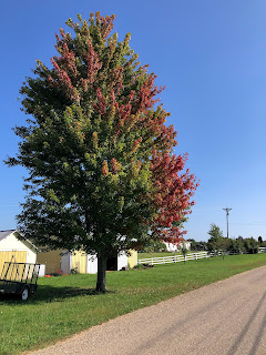
Morning view over the Ohio River Valley This morning fall was definitely in the air. After the light show last night (thunder and lightening and some decent rain) the temp had dropped considerably. Pete and I set off, leaving Betsy at our cool AirBnB loft, trying to make some final reservations for the end of our trip.  The start was very similar to Betsy’s and my ride the day before, meaning lots of hills and dales, through fields and woods and (truth be told) lots of run-down houses with a plethora of junk cars in the yards. We were seeing the under-belly of the US. There is poverty here for sure. But lots of natural beauty as well.  At one point, after seeing a “detour” sign, we cruised down a hill, and looked up – and up – and up – at the next (really BIG) hill, and Pete said “Wait a minute. That hill was not noted on the map.” So, we stopped and studied the map for a bit and tried to access Googlemaps (of course there was no coverage when we needed it!) In the end, we ...

September 21: Zanesville to Barnesville 50.7 miles, 2848 ft elevation climb 🥵

Image
  Today we had a lovely ride out on country roads, no shoulder, but almost no traffic.  The hills were challenging.  The inclines steep.  In one place there was a 9% grade.  Did I mention that we climbed really steep hills today?  We were, of course, rewarded with lovely and quite fast descents! So today I was thinking about signs, signals and omens.  The picture above shows a sign that tomorrow really is the first day of Fall. People in upstate NY believe that the amount of brown on a wooly bear signals the temperatures of the upcoming winter.  I guess that maybe the wooly bears are not in agreement this year. Lisa and I agreed that this sign was an omen about the amount of truck traffic on Salem Road today.  We only needed to jump off the road twice! This usually means that Lisa is about to be bitten or stung by an insect.  Today it meant that she was about to take a photo. Churches signal that a village is just around the b...

September 19 & 20

Image
Mural along the way to Columbus  We woke up almost bright and not so early in Waynesville. The rain the had been promised did not materialize. (rain dodgers rule!) Unfortunately the full breakfast that had been promised us by our hotel did not materialize ( we were offered a power bar instead😡). undeterred we began packing up to head out for a real breakfast in Xenia.  Thats when we found the fanny pack left behind by Nanette,  another biker who had stayed at the hotel. As there was literally NO ONE working at the hotel that morning, we strapped the pack to our bikes and headed north. Betsy sagged today and Lisa and I flew down the flat paved trail.  Breakfast was a "leisurely" affair as the restaurant was full and had just one kid working (pretty sure his first day on the job!) As we approached our night's lodging on the trail we got a phone call from a panicked woman looking for her fanny pack.  Yes, we had it.  Yes everything was in it. Yes, we have lef...

September 18: Cincinnati to Waynesville OH, 57.7 miles on the Ohio to Erie Trail (OTET)

Image
We set off from Cincinnati by 9 AM.  We have adopted a much more leisurely schedule since leaving the heat of Kansas.  We no longer feel pressed to finish our rides by noon to beat the afternoon sun.  The shady riding of the Katy Trail set us into a new rhythm which feels much less pressured and enables us to stop and drink the coffee! Pete drove today.  Lisa and I set off from the Riverfront park. It was another beautiful morning.  The ride took us first along the Ohio River, where those riding the entire OTET dip their rear wheels.  We then had to navigate the more industrial portions of the city until we hooked up with the Little Miami Trail.  We had a few (ok, more than a few) wrong turns because the trail wasn't as well marked as I had remembered from a previous trip with the Bladeks when we completed the entire OTET together.  This time we will go only as far as Columbus. Today our goal was Waynesville. ...

September 16: Oldenburg IN to Cincinnati: Ohio has a mountain! 47 miles 2146 ft elevation

Image
  We had a lovely ride through the Indiana countryside, and a crazy, hectic, dangerous ride into Cincinnati including a mountain which seemed to be the same grade as McKenzie Pass in the Cascades without the glory of reaching a summit and having your pals cheer and do cartwheels.  Just a lot of sweat!  We are no longer on any route system so had to rely on google maps bike option.  It seemed to work fairly well. Had a lovely reunion with friends Peter and Ann of Virginia, delicious pizza and a tour of the Mt. Adams section of Cincinnati which is a vibrant neighborhood with a stunning view over the Ohio River. Tomorrow is a day off to visit the city under the guidance of Peter and Ann.  On Sunday we head off on the Ohio-to-Erie trail towards Columbus and then east on the Chicago to NYC Adventure cycling route from Zanesville to Pittsburgh where we will start the Great Allegheny Passage.  We seem to be on our way home.

September 15 : Martinsville to Greensburg SAG to Oldenburg/from the Bikers Perspective

Image
Today dawned with clear blue skies – and we had some pretty decent coffee and breakfast at our hotel (that is not a given, by the way!) After a quick chat with Helena (also not a given, since she’s on Italian time) Pete and I set out, while Betsy drove ahead to our intermediate point of Edinburg to scout out a lunch spot and bike back to meet us.  Once again, Pete demonstrated his superior navigating skills getting us out of the industrial area safely and onto a beautiful country road, where we stopped for his morning picture (he’s taken one every morning of our trip.) I hope he puts them altogether into a big collage, reflecting the diversity of the landscapes we’ve seen on this epic adventure!  The road was so quiet that we could actually ride side by side for a bit, and we decided that this was one of the most beautiful rides we’d done on the trip (aside from the Painted Hills, and Wyoming and that ride over the pass in Oregon and, and, and) Well, maybe it wasn’t the most...

September 15: Martinsville to Greensburg (SAG to Oldenburg). 63 miles. Perspective of a SAG driver.

Image
By now most readers know that SAG refers to the the driver and vehicle that the riders rely on.  SAG stands for Support and Gear.  More realistically, all the stuff the riders have no intention of carrying on their bikes.  The SAG driver has many duties, which in our group are not really outlined and seem to vary between drivers or even the day.  First and foremost duty is moving the car and stuff to the next location so we can then drag everything into our place of lodging for the night only to return it all to the car in the morning.  Often if feels as though we spend more time moving our stuff here and there, up and down, than riding........OK not really, just feels like it. Other duties include stopping for gas, shopping for groceries, filling the water cooler and finding a place for a picnic lunch.  Sometimes being able to find a parking spot is the most arduous of jobs.  Some SAG drivers have been known to park in cemeteries, or in a di...